
The World Economic Forum’s Global Risk Report 2026 lists extreme weather events in the top 4 risks in both the short (2 years) and long term (10 years) [1]. So, it’s good to see that a new long term flood risk dataset for English homes is available from Defra. It enables users to search multiple postcodes which is much better than one postcode at a time that was previously available. That said, a bit of knowledge of Power Query functions will be necessary to use the dataset as it is too big to sit on any single Excel file.
The accompanying notes to the dataset explain the results. The number of addresses within the postcode that are at high, medium or low risk are reported. The assumption is that any other addresses are very low risk. These risks are the highest of either sea, surface water or groundwater flood sources.
As with the long-term flood risk map, the risk is the area around an address rather than the actual address. We have seen previously that even this kind of data can give landlords a good head start on adapting homes to climate change.
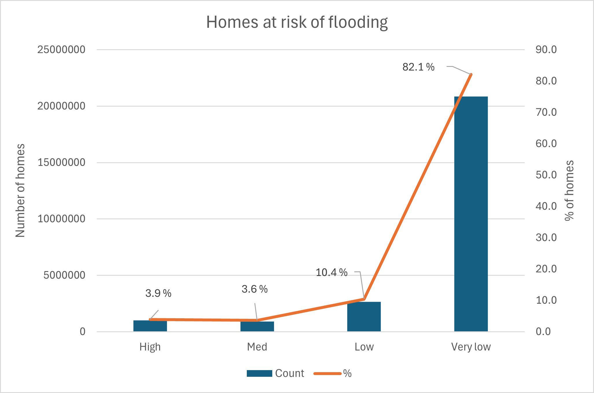
Looking at the dataset we can see some overall figures for English homes. The chart below shows the number and percentage of homes in each of the flood risk categories:
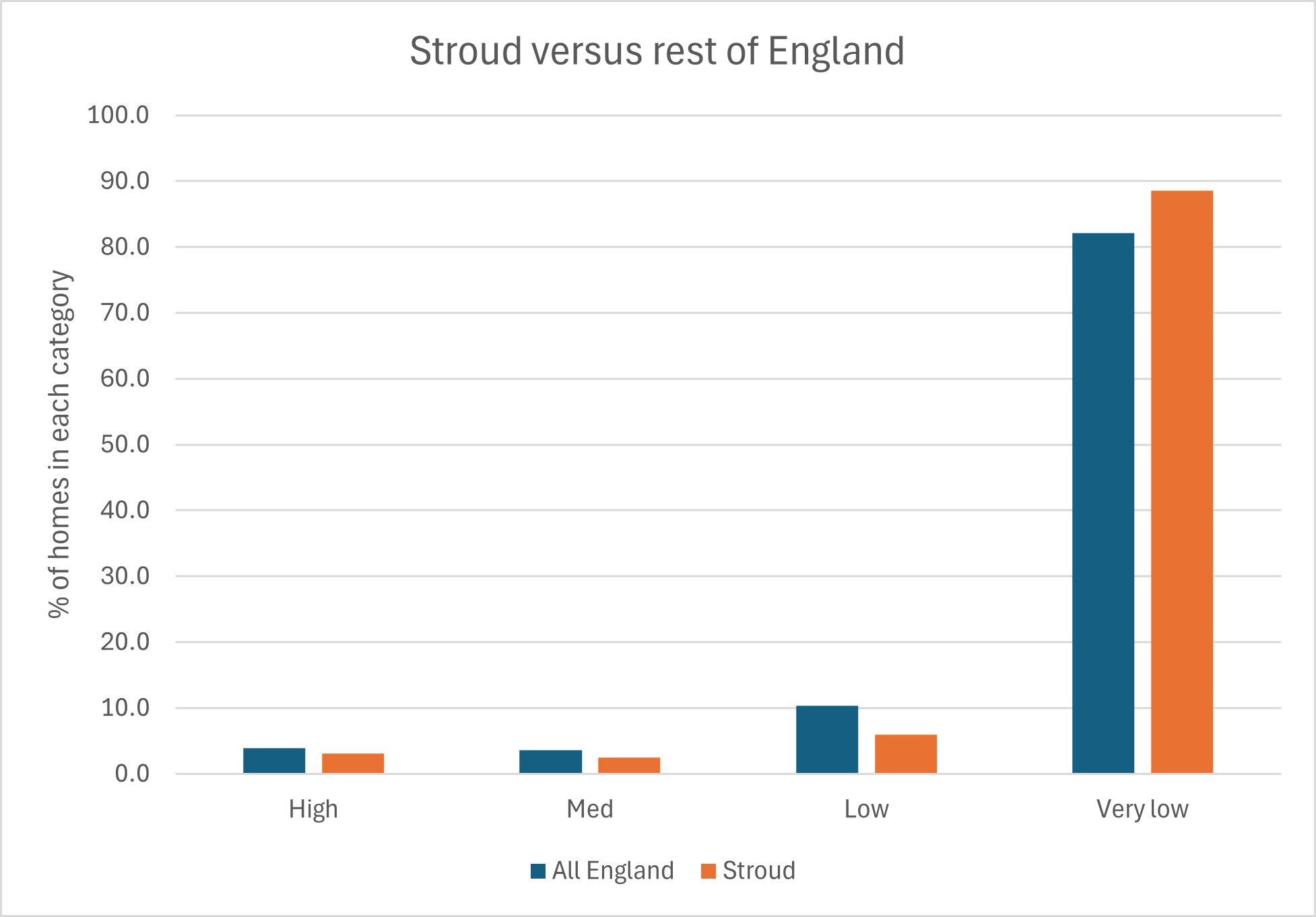
The dataset also allows a bit more of a granular search. We are based in Stroud, Gloucestershire and the chart below shows how the homes near us compare with the rest of England:
This is a promising and useful dataset that will allow landlords to easily check flood risks based on Defra data. We will be investigating similar datasets for Wales and Scotland. As Defra intends to update this data annually in line with the latest hydrological models and data, we will look to incorporate the data into our annual SHIFT assessments later in the year.
Next steps
Out of pure interest, you may be interested to check out the flood risk of your own home in England [2], Wales [3] or Scotland [4].
For UK social landlords we have designed a climate risk adaptation strategy that is useful to protect homes and residents. If you would like us to look at the flood risk for your properties together with other environmental reporting, please be in touch: https://shiftenvironment.co.uk/contact/
[1] https://www.weforum.org/publications/global-risks-report-2026/infographics-global-risks-report-2026/
[2] www.gov.uk/check-long-term-flood-risk
[3] www.naturalresources.wales/flooding/check-your-flood-risk-by-postcode
[4] https://map.sepa.org.uk/floodmaps/FloodRisk/FutureFloodMaps
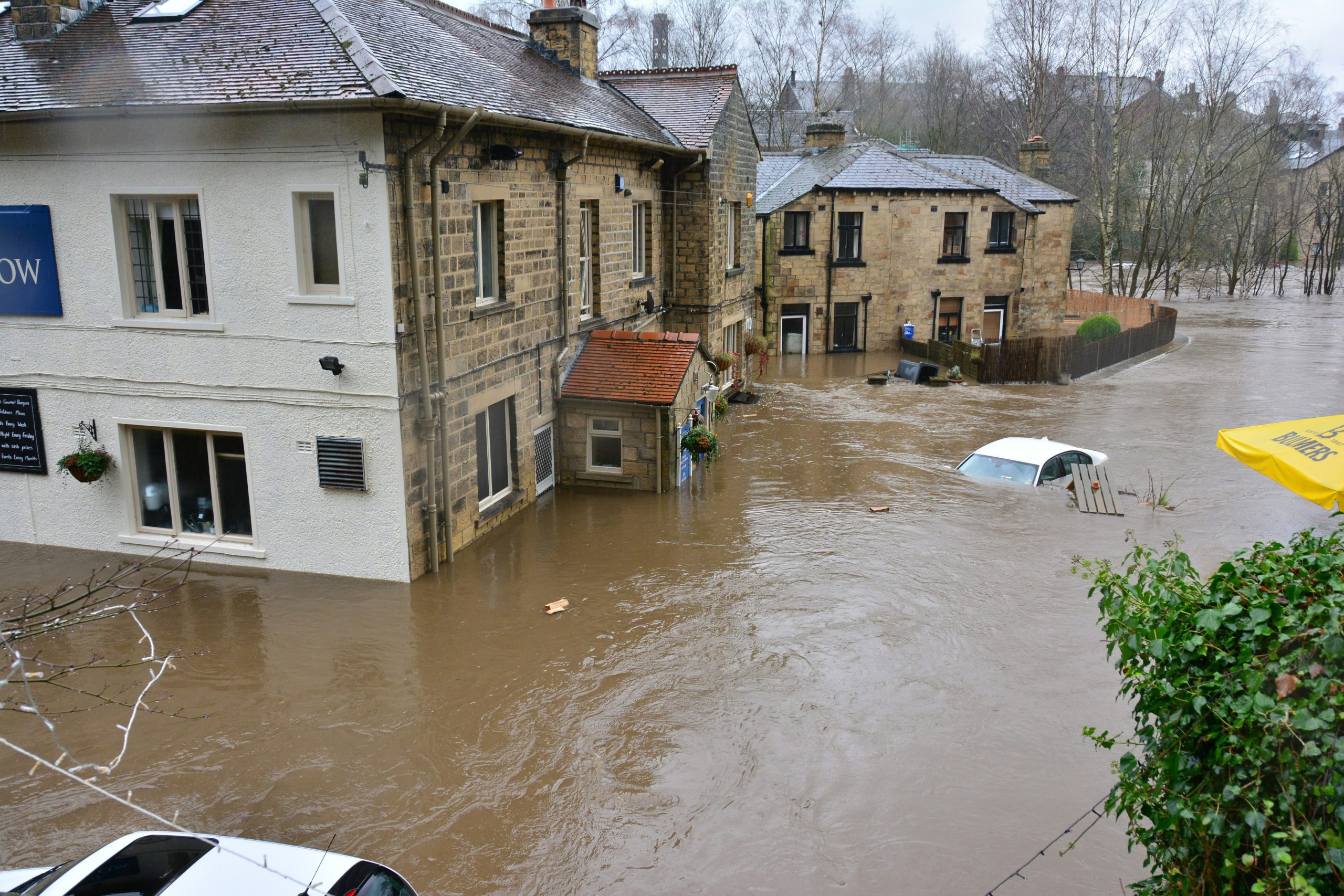
Photo by Chris Gallagher on Unsplash