Drones, or to give them their technical title, Unmanned Aerial Vehicles (UAVs), are a rapidly advancing, versatile technology that is already having a major impact on a variety of sectors. Asher, one of our SHIFT Environmental Assessors, undertook research investigating the optimal Ground Sampling Distance (GSD) for UAVs surveying scrub vegetation (within UK legal restrictions). This involved using a consumer grade UAV to capture images of a small sample area containing a mix of scrub vegetation and grassland, at six different GSDs (30, 40, 60, 80, 100, and 120 metres). Photogrammetry software was used to ‘stitch’ these overlapping images together and generate 3D surface and terrain models. Using these models and Geographical Information Systems (GIS) software, scrub vegetation (1-5 metres tall) was isolated from other vegetation types. The selection of the optimal GSD was based on a trade-off between accuracy of measurements of the scrub layer made using the software (lower GSD results in greater resolution and accuracy), the time taken to survey the study area, the storage needed for the data, and the processing time associated with each GSD. It was found that the difference in accuracy between 30m and 120m was almost negligible, whilst the survey time, processing time, and storage needed increased exponentially as GSD decreased. Therefore, the 120m GSD was selected as the optimal GSD.
We don’t believe drones will ever completely replace specialist ecologists working on the ground, but here are five reasons UAV and associated technologies should be implemented in the monitoring of vegetation, biomass and biodiversity more widely:
- Rapid data collection
Most UAVs fall into two categories, either multi-rotor models (e.g., quadcopters) or fixed wing models. UAVs are rapidly deployable and cover ground much more quickly and efficiently than ground-based methods. Therefore, they ideal for monitoring dynamic and rapidly changing environments. Although ground-based methods give helpful insight into the overall situation, they involve a certain amount of estimation, are resource intensive, inaccurate, and disturb wildlife.
- Data Accuracy and Standardisation of practices
Equipped with increasingly advanced software and GPS, UAVs collect data with a high level of accuracy using flight parameters set by the user (e.g., flight altitude, flight speed, location). This allows future studies to replicate previous flight parameters and methods, leading to better standardisation of practices. This consistency also allows precise comparisons of changes to landscapes over time.
- High-resolution imaging from an aerial perspective
High-resolution aerial imagery allows researchers to survey vast areas efficiently. Higher levels of detail (compared to satellite imagery) combined with photogrammetry and Geographical Information System (GIS) software allows researchers to accurately measure vegetation types, including canopy density, vegetation health, and even distinguish between individual plant species.
- Cost-effective
Although initial investment in UAV technology can seem significant, when compared to the cost of large field teams and the associated cost of workforce hours, travel, and equipment etc, the long-term cost savings are substantial. In addition to this, when compared to other forms of aerial imaging such as through manned aircraft, UAV technology is extremely cost-effective.
- Range of applications with customisable sensors
Modern lightweight UAVs can now be equipped with a variety of multispectral and hyperspectral sensors such as optical cameras, thermal sensors, Light Detection and Ranging (LiDAR) sensors, and Ground Penetrating Radar (GPR) sensors. Examples of applications include monitoring vegetation (e.g., growth, stress, biomass, carbon content) and ground cover, direct and indirect wildlife monitoring, moisture levels, hydrology and flood mapping, and more. Companies and researchers can tailor their UAV’s capabilities to their individual needs. Rapid advancement in UAV technology means that the newest models now have better capabilities in extreme and wet weather.
Ecosystem services provided by nature are essential to a healthy economy, society, and environment. Therefore, it is essential that landowners prioritise preserving and enhancing the quality of green spaces. Some benefits of this include flood attenuation, summer cooling, air quality improvement, carbon sequestration, recreational value, space for wildlife, and increased physical and mental wellbeing.
At SHIFT Environment, our strong conviction is that effective assessments of biomass and biodiversity require robust metrics. Many companies use outdated and inaccurate methods for these assessments, resulting in poor quality data. The use of UAVs will allow companies to gather accurate quantitative data and precisely measure changes to their green spaces and biodiversity over time.
We are currently carrying out trials on biodiversity measurement using earth observation data. If you would like to be kept up to date on that please sign up to our newsletter below.
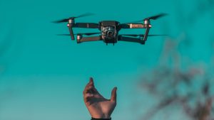
Photo by Diana Măceşanu on Unsplash