
Our SHIFT Assessor, Sam McConnochie, has recently learnt that he won the Royal Geographical Society Planning and Environment Research Group’s prize! This is a national award that goes to the best undergraduate dissertation relating to planning, environmental policy, infrastructure and environmental geography. Here’s what he found.
England has an extensive history of widespread flooding and with a changing climate increasing the regularity of extreme weather events, it is vital that the vulnerability of England’s road networks to flooding is understood to reduce the risks and impacts for the public and economy. In my study, I spatially intersected a variety of fluvial and tidal flood scenarios with the national road network. Total population, elderly and disabled demographic data sets were also included in the analysis, to create a more expansive approach to the assessment of road network flood vulnerability in England. For social landlords, take a look at the maps below and see where your housing stock is located.
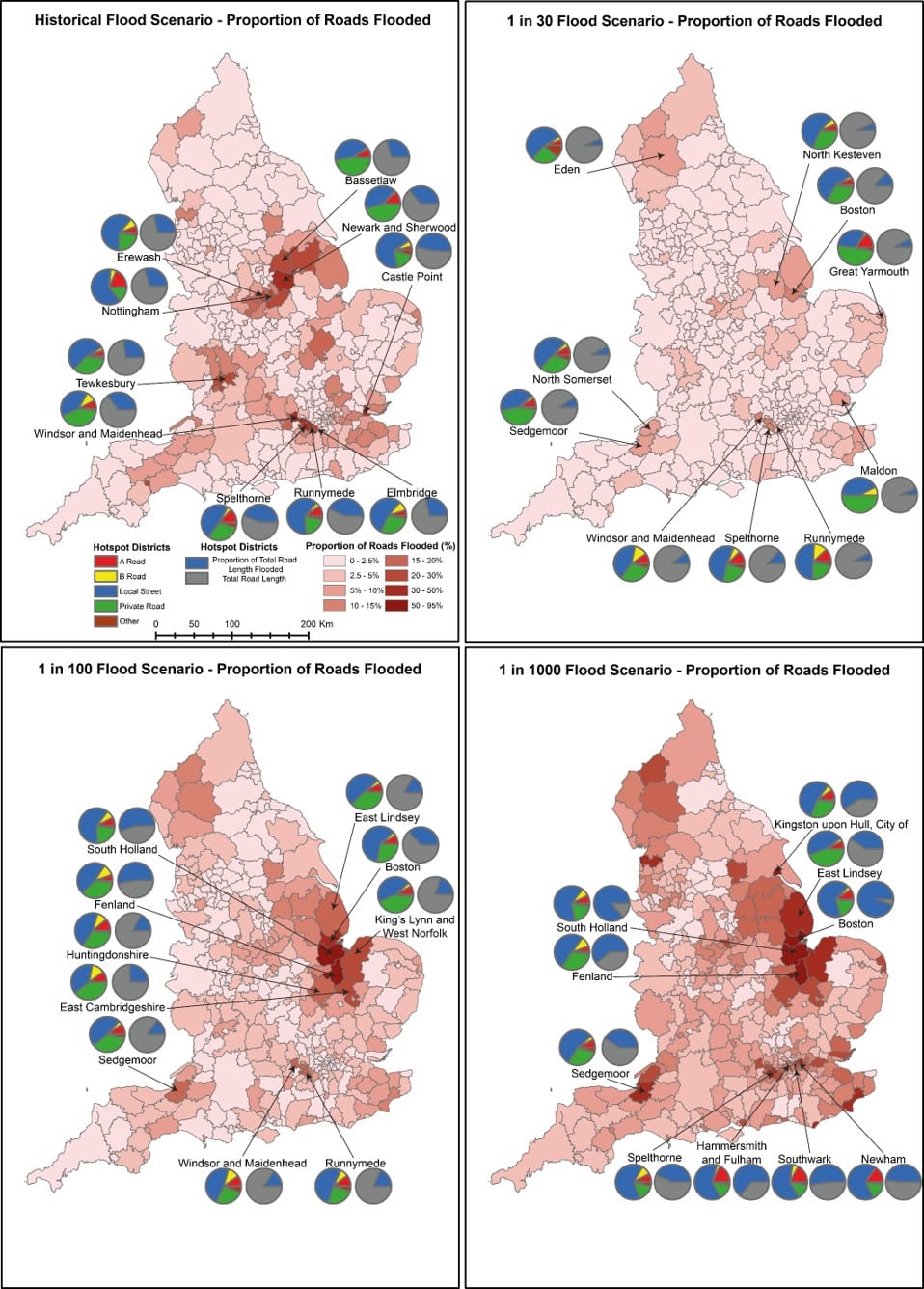
This analysis presented mixed messages, as it could be inferred that road network flood risk is being managed effectively, as the top ten most vulnerable districts in Figure 1 for outright road network flooding have a comparatively low, average population meaning that impacts and risks are being experienced by a smaller proportion of society.
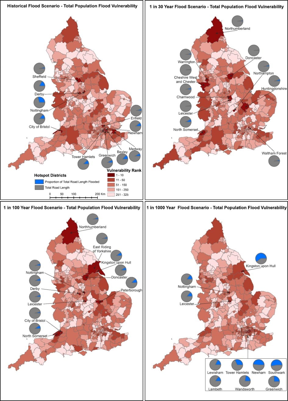
Figure 2 also evidences that, to some extent, the cost-benefit analysis framework used in UK flood management is performing correctly, as the most vulnerable districts identified using population density represent a significantly lower proportion of road network flooding than those in Figure 1.
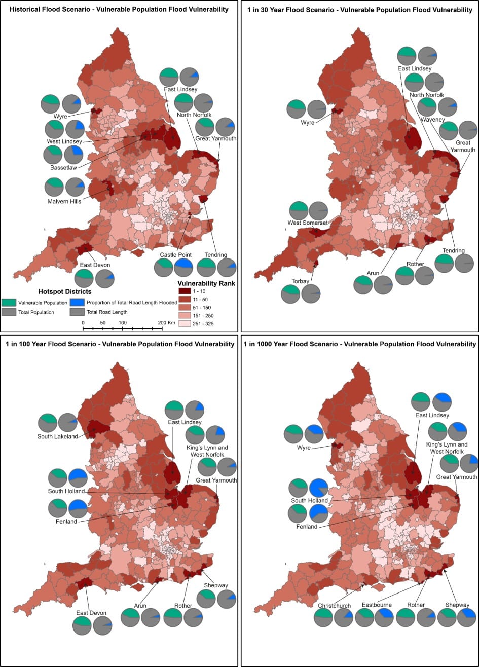
Whilst the most vulnerable districts shown in Figure 3 contain the largest proportion of vulnerable populations exposed to road network flooding, they do have comparatively small average populations. However, a concerning pattern is that these districts represent a far higher proportion of total road network flooding compare to the districts in Figure 2. This potentially reflects an inequality in national flood risk management, as most vulnerable districts in Figure 3 are located on the coast compared to a minority in Figure 2.
It is paramount that mitigation against the economic losses that road network flooding causes is prioritised, as the Environment Agency estimates that daily economic losses caused by flood disruption in the United Kingdom’s infrastructure could range from £2 billion to £10 billion depending upon the magnitude of the flood event. In the most recent Long-Term Investment Scenarios (LTIS) Report, the Environment Agency estimates that in a 0.1% AEP flood event, 30% of the UK road network could be directly or indirectly disrupted.
I hope this research has demonstrated how important it is for housing associations to understand the risks and impacts that road network flooding will have for your tenants as well as your ability to operate effectively as an organisation. If you would like to read my dissertation in full contact me at [email protected]